Quimby Mountain's Stewardship Plan Is Approved. Trailhead Funding Remains Unsettled.
At the end of Quimby Mountain Road, the pavement widens into a cul-de-sac and then stops. Past the turnaround, a path continues into the trees, unmarked and unofficial, worn into the ground by years of foot traffic, with "No Trespassing" signs nearby. The Union Leader describes a climb of about 350 feet over less than a mile to Hooksett's highest point, a little over 900 feet above sea level, with views west toward the Uncanoonuc Mountains and north across Manchester. People have been walking it for years. The town has never built it, marked it, or maintained it.
That's changing, slowly, and the way it's changing tells you more about how conservation land actually gets built out than the stewardship plan headline does on its own.
In late July, the Hooksett Town Council approved a stewardship plan for the Quimby Mountain Conservation Area after nearly an hour of discussion, much of it addressing concerns from property owners who live near the site. The plan, drafted by the ecological consulting firm Moosewood Ecological, lays out how the town should manage the roughly 97-acre parcel it has owned since 1985 and placed under a conservation easement in 2012. It's the document that has to exist before any trail construction can start.
Less than two weeks later, on August 10, the Hooksett Conservation Commission took up the next piece: a proposal from the engineering firm Stantec to design an access drive and parking area off Goffstown Road, the spot the town has identified for the future trailhead. The commission tabled it. Members said the roughly $36,000 quote, which included a $13,000 line item for permitting alone, didn't come with enough detail about total project cost to approve on the spot. The Citizen Portal report quotes Commissioner John Pieroni saying, "I just feel like we should put the brakes on a little bit," and notes that he argued the town needed a fuller estimate covering the driveway, parking, drainage, and trail work before committing reserve funds. Staff were asked to come back with comparative quotes and a clearer accounting of what's excluded from the current number.
If the funding clears at a future meeting, construction could begin in 2027. Until then, Goffstown Road has no trailhead, and Quimby Mountain Road remains the only way most people find the summit, unofficial signage and all.
Here's the short version of how the last four decades got to this point:
That's not a project stalling out. It's what due diligence on a public trail actually looks like when the people voting on it are also the people who'll answer for the bill later. But if you were watching the headlines and assumed a trail was close because a plan got approved, the money to build the parts a hiker actually needs, the road in and the place to leave your car, hasn't cleared yet.
The ecological survey behind the stewardship plan documented features of the property that are not apparent from Goffstown Road.
The Union Leader quotes JoCarol Woodburn, co-chair of the Conservation Commission: "There are over 43 species of conservation concern on this property, and there happens to be a 600-year-old black gum tree, which is thought to be one of the oldest trees in New England." The tree grows in a forested swamp on the property, one of the natural communities the stewardship plan flags as rare or sensitive at the state level. Nearby, the site also supports American chestnut resprouts, root systems that survived the blight that wiped out the species across New England a century ago, some now several inches in diameter.
Wildlife surveys conducted for the stewardship plan turned up regular presence of black bear, bobcat, deer, and coyote, species that typically need thousands to tens of thousands of acres to sustain themselves. Quimby Mountain can't meet that need on its own, but the stewardship plan describes it as part of a larger network of undeveloped land nearby that lets those species move, forage, and adapt, the kind of connectivity a single, isolated parcel can't provide.
The Hooksett Conservation Commission blog quotes Dr. Alan Stein, the commission's other co-chair:
"Quimby Mountain is a quiet refuge for visitors to connect with the natural environment. It's a rare opportunity to experience a landscape that has remained largely unchanged for decades. A residential development was planned here in the 90s; we are very fortunate to protect this area in perpetuity."
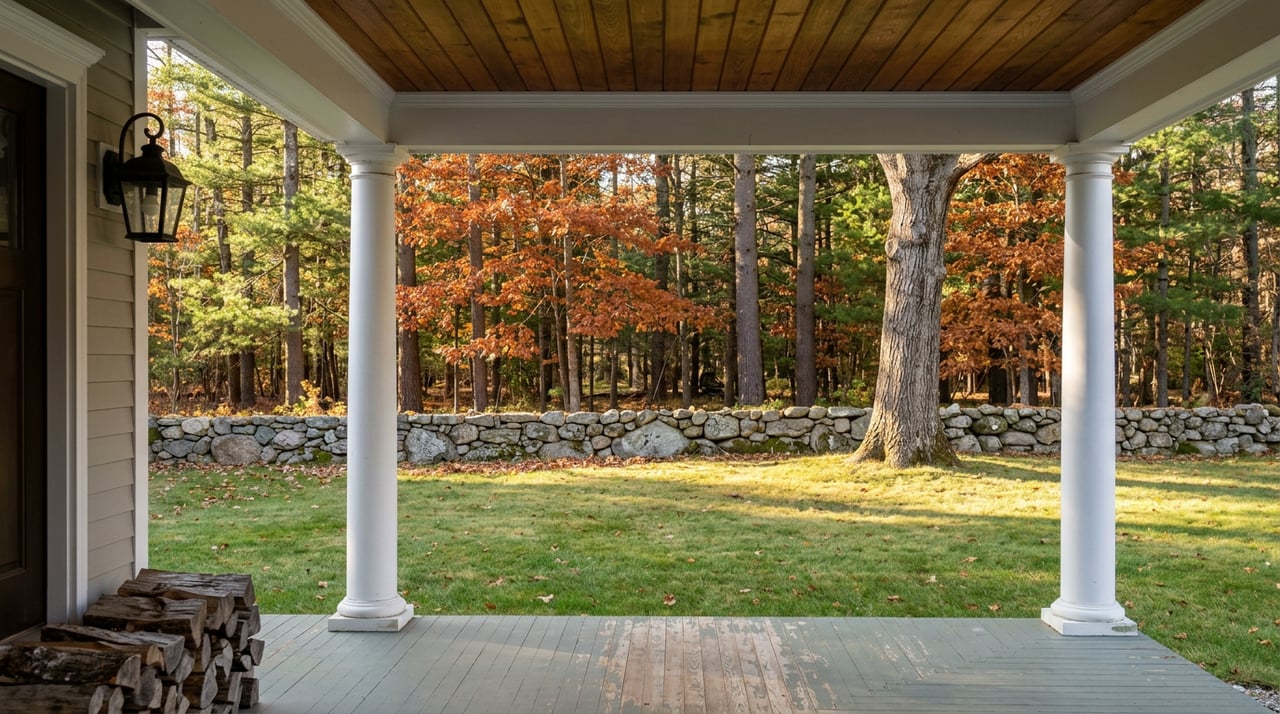
That's the frame worth sitting with. The mountain almost became house lots. Instead it became the thing residents on the west side of town walk to on a Saturday morning, informally, without a sign telling them where the property line actually runs.
There are two routes associated with Quimby Mountain, but they're not interchangeable.
The herd path off the Quimby Mountain Road cul-de-sac is the one people have used for years. It's steeper and unofficial, and it runs close to posted private land near the top, since the summit itself is split three ways between the town, the 20th Skeet & Clays gun club on Goffstown Road, and a private landowner near the Hooksett-Dunbarton line. Hikers who've used it recommend going in daylight, out of consideration for the neighbors whose backyards border the route.
The planned town trail is a different animal entirely, and it doesn't exist yet. When it's built, it will start from a dedicated parking lot off Goffstown Road, on land the town actually owns outright, and climb the same 350 feet over less than a mile at a grade the stewardship plan calls appropriate for a low-impact, family-friendly hike, a notably gentler profile than most New Hampshire summit trails.
Until the access road funding clears, that second path is a plan on paper. The first one is still the only way most people reach the top.
Hooksett doesn't get talked about as a hiking town. It gets talked about as the place between Manchester and Concord, the highway exits, the outlet malls along Route 3. Quimby Mountain doesn't fit that description, and that's sort of the point. It's high ground with a 600-year-old tree on it, five minutes from houses on Goffstown Road, and until recently almost nobody outside the Conservation Commission's meetings knew it was there.
The town's caution about the Stantec proposal isn't a story about a stalled project. It's what it looks like when a small town tries to build public access to genuinely rare land without overcommitting reserve funds on a rough estimate. The land isn't going anywhere. Neither, for now, is the parking lot.
If you're already walking Hooksett's trails this fall, whether that's the flat stretch out to Head's Pond or the unofficial path up Quimby, you're seeing a town quietly investing in the ground under its own feet before it invests in anything flashier. That's worth knowing whether or not you ever plan to buy a house here.
If you're weighing what a piece of property near land like this is actually worth, long term, Gail McCarthy at REEN USA has spent two decades looking at New Hampshire real estate from both sides of the closing table. Let's Connect.
This article is general information, not legal, tax or financial advice. Consult a qualified professional about your situation.
From the first conversation to closing day, Gail delivers thoughtful guidance, responsive communication, and a high level of professionalism. Her experience in both property ownership and brokerage gives clients a practical, informed perspective that helps them move forward with greater confidence.
23 BARBERRY ST HOOKSETT, NH 03106 MON - SUN, 9 AM - 5 PM OR BY APPOINTMENT